If you have spent time doing family tree research looking at census records, you will want to know what "enumeration district" means. Find out the answer, as well as how to find district maps, in this post.
The US Federal Census is taken every ten years and is a function of the government that is mandated by the US Constitution. While the government finds the census data crucial for the division of resources, community planning, and, of course, determining how many seats in the House of Representatives to assign to each state, family tree researchers use census data to learn about their ancestors.

Did those who wrote the Constitution envision that millions of amateur and professional genealogists, historians, and family history buffs would be using census records from generations prior to trace their ancestors' stories through time?
I don't know, but I am certainly glad that the decennial census was hard-coded into the way things are done, and that census records have generally been so well-preserved.
There is a lot of information on census records, but it can be hard to make sense of without understanding some of the terminology that is specific to the way that the census is taken every ten years. My goal with this article is to help explain the meaning of enumeration district so that census records will become one of the most important categories of genealogy records that you turn to in your research.
Enumeration district meaning on the census
An enumeration district is a geographic area, ranging from a few blocks in a city to an entire town or county, that can be enumerated, or counted, by a census taker within the allotted census period. Census takers who interview and count residents in enumeration districts are called enumerators.
Enumeration districts are not the same each time the census is taken, since residential patterns change over time. In addition, since 1910, there has been a general trend towards having enumeration districts line up with legal boundaries.
What does ED mean on the census?
ED is an initialism, that stands for "enumeration district". All of the information in this article applies to enumeration district, as well as "E. D.", which is a shortened nickname of sorts.
It is pronounced by saying the letters E and D, which is why it's nickname is an initialism instead of an acronym.
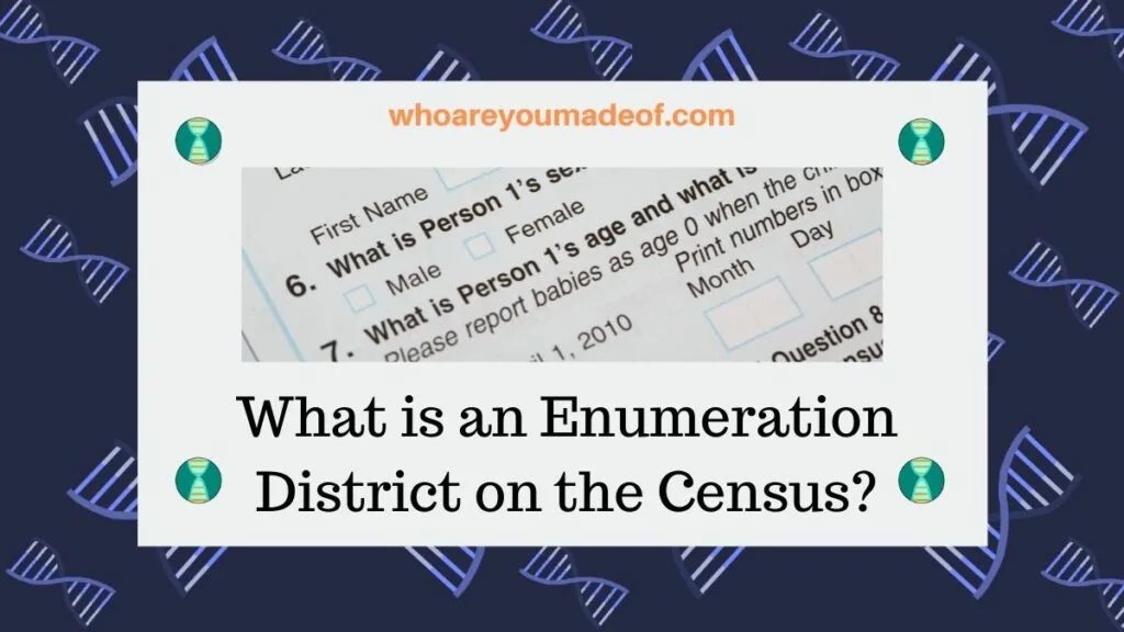
You may also occasionally see "Enum. Dist. No." which is an abbreviation for "Enumeration District Number" as a field at the top of the census reporting form. This is how it is listed on the 1900 US Federal Census form, for example, as shown below:
How big are enumeration districts?
Enumeration districts will range in size depending on how heavily populated the area is. For example, in a big, densely populated city, the enumeration districts will be small in size but include lots of people.
Enumeration districts in rural areas could cover vast amounts of land and relatively fewer people.
The reason that urban enumerations are smaller in geographic area than rural districts is because of the limitations of what a human census taker can realistically accomplish during the census data collection period.
What is the enumeration number on the US Census?
Enumeration districts are assigned numbers, which usually include two numbers that are separated by a dash symbol. The first number is the number assigned to that county for the census period and the second number is assigned to that specific enumeration period for the specific census.
Not every US Federal Census used enumeration district numbers. District numbers were assigned by census planners in time for the 1880 Federal Census.
The population of the United States grew by 20-35% each decade of the 1800s, which may have been the reason that the government decided to divide some districts into smaller geographic areas in order for census takers to be able to complete their tasks in a timely manner. Census records prior to 1880 typically include the name of the post office or town where the residents recorded on the census form lived at that time.
Does the enumeration district number change?
The enumeration district numbers and boundaries generally change with each census year, since any given geographic area may experience many changes in the ten year period between censuses. For example, regions might experience dramatic population shifts from farms to cities, new roads might be built, or buildings which housed dozens of families demolished.
Those of us researching our family trees have certainly noticed how our ancestors moved around from farm to city or from state to state, following historic growth patterns.
Furthermore, legal boundaries of counties, cities, and towns change over time. Brand-new cities and towns are formed as population centers shift.
A great real-life example of how and why an enumeration district might change comes from the discontinued use of tuberculosis sanatoriums, hospitals where patients suffering from what is often referred to as the "Great White Plague" often stayed long-term during their treatment for the illness.
By the middle of the 1920's, more than 675,000 beds were available in a large number of sanatoriums across the United States. Patients would often quarantine at these institutions for months at a time while receiving medical care.
Some of these sanatoriums had hundreds of beds. In many cases, patients of a sanatorium were counted as a residents (typically described as "inmates") of the sanatorium, which would affect the total population of that enumeration district.
This exactly how the residents of the Essex Mountain Sanatorium, with more than 400 TB beds, were counted for the 1940 US Federal Census.
However, once these institutions closed and other large residential homes established for different reasons, such as boys and girls homes (also referred to as orphanages), ceased to be used, census planners changed the boundaries of the enumeration district for the next census.
How to find census enumeration district maps
There are multiple ways to find census enumeration district maps. The most common census district maps modern researchers search for are the 1930 and 1940 district maps.
You can click on the following link to be directed to the Family Search website to learn more about finding enumeration district maps for the 1930 and 1940 US Federal Census, as well as others:
It is a perfect time to learn about how planners designed and used enumeration maps, since the dedicated family tree researcher will be able to use enumeration district numbers and other details to find their ancestors on the 1950 census when it is released later this year, without having access to the name index for that census, which will likely take a long time to complete.
Conclusion
I hope that this post has helped you learn more about enumeration districts and how to find enumeration district maps, and so much more.
If you have any questions about something that you read in this post, or if you would like to add a bit of information about how you have used enumeration districts to learn more about your family, I would love to hear from you in the discussion below.
Thanks for stopping by today!